- The Kalunga represents a grouping of 39 traditional quilombola communities — the descendants of runaway slaves — living on a territory covering 262,000 hectares (647,000 acres) in Goiás state in central Brazil, within the Cerrado savanna biome.
- This territory has been under heavy assault by illegal invaders, including small-scale wildcat gold miners, and large-scale mining operations, as well as land grabbers who have destroyed native vegetation to grow soy and other agribusiness crops.
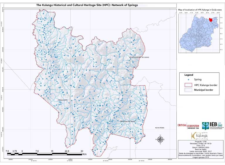
- To defend their lands, the Kalunga partnered with the Criti¬cal Ecosystem Partnership Fund (CEPF), supported by the EU, Japan, World Bank, Conservation International and others. With their funding, the Kalunga georeferenced the territory, pinpointing homes, crops, soils, 879 springs, and vital natural resources.
- In February 2020, the U.N. Environment Programme and World Conservation Monitoring Centre (UNEP-WCMC) recognized the Kalunga Historical and Cultural Heritage Site as the first TICCA (Territories and Areas Conserved by Indigenous and Local Communities) in Brazil, making it what UNEP-WCMC calls a “Territory for Life.”
“We, the 39 Kalunga communities, have carried out the georeferencing of our land. And now we have an important tool for managing and protecting our territory! It will help us plan our future,” declared Jorge Oliveira, president of the Quilombola Kalunga Association (AQK).
Georeferencing, accomplished with the help of international players, represents a huge achievement and step forward for these traditional communities, who occupy the largest quilombo in Brazil, located in the northeast of Goiás state in central Brazil, within the Cerrado savanna biome.
The Kalunga Historical and Cultural Heritage Site (Sítio Histórico e Patrimônio Cultural Kalunga) occupies a vast area — 262,000 hectares (647,000 acres) — and lies near Chapada dos Veadeiros National Park, renowned for its biodiversity and as a UNESCO World Heritage Site. Quilombolas are the descendants of runaway slaves, and their territories, known as quilombos, were guaranteed under the 1988 Brazilian Constitution. But the government has long failed to protect these communally held lands, putting them at risk of invasion by outside exploiters.
Today, the Kalunga territory is one of the best-preserved areas in the Brazilian Cerrado. It has no fewer than 879 natural water springs, many of which feed into the Paranã River, which flows north into the Tocantins River. It is also home to 19 endangered species of plants and animals, which the Kalunga endeavor to protect.
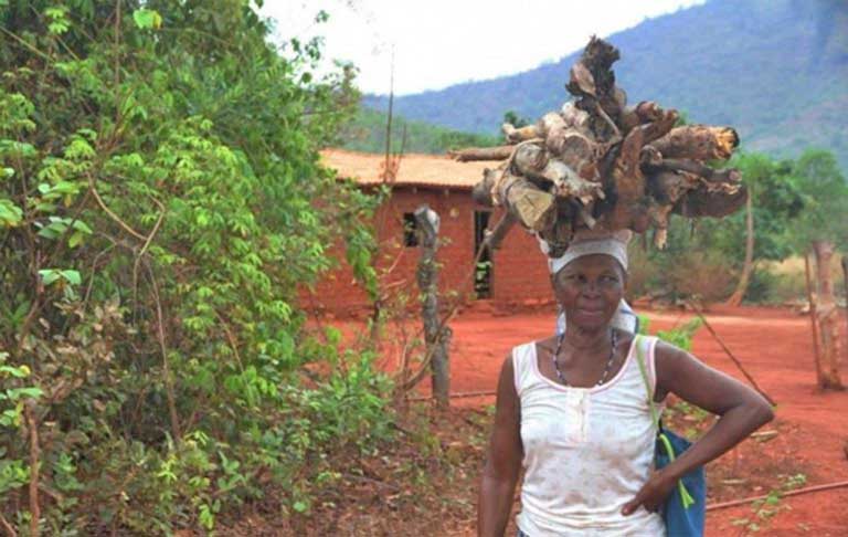
A longtime claim to valuable Cerrado lands
The region occupied by the Kalunga was originally occupied by Indigenous peoples. But some 300 years ago, escaped slaves, many fleeing dehumanizing conditions in gold mines, began settling here.
The land made an ideal refuge, only accessible by crossing steep mountains with almost perpendicular rock faces. The former slaves named themselves the “Kalunga,” with various conflicting theories as to why. They coexisted harmoniously with the Indigenous people, learning from them how to manage this semi-arid land sustainably.
The Kalunga remained isolated from the rest of Brazil for many years, even after slavery ended in 1888. According to anthropologist Mari Baiocchi, one of the first to do research there, the Kalunga mistook her and her team for undercover military agents when she first arrived in 1982. Community members were alarmed, she wrote, for the Kalunga “believed they would be arrested and taken back into slavery.”
The Kalunga’s Cerrado land holdings were officially recognized as a quilombo by Brazilian authorities in 1996. But the quilombolas realized that, if they were to survive culturally, they would need to emerge from their past of political invisibility.


From 2004 onward, the communities took advantage of public policies created to benefit traditional peoples, including access to education at federal institutions and public universities. Vilmar Souza Costa was in the first small group of Kalunga students to gain degrees in rural education at the University of Brasília. Since then, more than 200 Kalunga have graduated, with many now working as teachers in their territory.
Education empowered the Kalunga, who demonstrated great courage over the years in the defense of their traditional lands. Teachers transformed this ongoing struggle against invaders into representation within the Brazilian political system. According to the National Coordination of Articulation of Black Rural Quilombola Communities (Coordenação Nacional de Articulação das Comunidades Negras Rurais Quilombolas), a national body that represents quilombolas, Vilmar Souza Costa, a former president of the AQK, was the only quilombola to be elected mayor in municipal elections held throughout Brazil last November.
“For you to have an idea of the scale of our previous exclusion, 80% of the population of Cavalcante [a Kalunga territory municipality] is quilombola, but it took us 188 years to get our first representative elected,” Costa said. His election has led to hopes that authorities may finally meet the Kalunga’s longstanding demands for public services, including health care and infrastructure investment.

Digital mapping removes room for dispute
But progress has remained slow on the all-important issue of land titles. Although the quilombo has been demarcated, disputes are still brewing regarding land occupied by non-Kalunga within the territory. Under the law, INCRA, the government’s land reform institute, is now obliged to forcibly purchase this land and to move out the non-Kalunga farmers, but this process hasn’t begun.
Only half (55.3%) of the communities’ land has been titled, leaving the rest very vulnerable to invasion. As a result, wildcat miners have moved onto the territory’s mineral-rich lands, while other outsiders, at the forefront of the rapidly advancing Cerrado agricultural frontier, are clearing land illegally to farm within the territory.
Community leaders say that land grabbers often register a 5-hectare (7-acre) plot outside the Kalunga territory, then use this legal foothold to create a farm of 700 hectares (1,700 acres), much of it within the quilombo.
To defend against current and future invasions, the Kalunga have undertaken the proper registration and classification of their resources, so they know which lands can be used for farming, which need protection, and so on, a process best carried out by georeferencing — the use of aerial images to create a geographic coordinate system to very accurately map a wide variety of ground features.
But georeferencing, also known as digital mapping, is expensive, especially for such a big territory. And the outlook for mapping help recently only got bleaker, with the election as president of Jair Bolsonaro, who has long expressed animosity toward quilombolas, once declaring before taking office that they were “not even fit for procreation.”
Fortunately for the Kalunga, before Bolsonaro’s election, they negotiated a partnership with the international Critical Ecosystem Partnership Fund (CEPF), which is supported by the European Union, Japan, the World Bank, Conservation International and other bodies. CEPF, set up in 2000, has as its objective the promotion of the conservation of high-priority biological areas. The Quilombola Kalunga Association (AQK) project was selected in 2018 for the program, becoming one of 40 such projects around the globe.

CEPF grant director Peggy Poncelet explained to Mongabay why the AQK was selected: “It’s very difficult for traditional communities to gain recognition of their territories, leaving them vulnerable to land grabs. And because this community is committed to conserving the incredible biodiversity found on their land, it was important for CEPF to provide them with the means to continue doing just that.”
Furnished with equipment and technical support, the Kalunga carried out thorough georeferencing of their whole territory between 2019 and 2021. Now, thanks to digital mapping, they know precisely where the 1,600 families in the territory live, what they produce, if they have access to electricity, the degree to which community water and soil resources are preserved, what type of farming the land is suited to, and more.
The CEPF also funds the Kalunga in its educational efforts, building environmental awareness in the region, particularly with respect to its 19 threatened species, including Griffinia nocturna, a plant that blooms and is pollinated at night, with flowers fading by the next morning; and two birds — the chestnut-bellied guan (Penelope ochrogaster) and the Chaco eagle (Harpyhaliaetus coronatus). The chestnut-bellied guan is endemic to the region and, according to the Kalunga, is found throughout their territory.
“In association with the municipal and state authorities, we publicize the list of threatened species, both inside the territory and outside,” said Durval Mota, a consultant for the project.
Jorge Oliveira, the AQK president, said, “We talk to students and teachers about the importance of preserving these species and protecting the quality of the water.”
Wave of invasions
The Kalunga say they hope that the now completed georeferencing project will serve as a valuable tool to help halt the newest wave of land invaders.
Oliveira tells of how he was targeted with violence in 2015: Trespassers “knocked down my home and then burned it, along with my fields, destroying the 45 bags of rice we’d already harvested,” he said. Oliveira, his wife and eight children then faced two very difficult years as the family worked to regrow the crops lost. No one has been charged with the crime, and aggression against the Kalunga continues. In February, a house in Vão das Almas, one of the quilombola communities, was demolished with a chain saw.
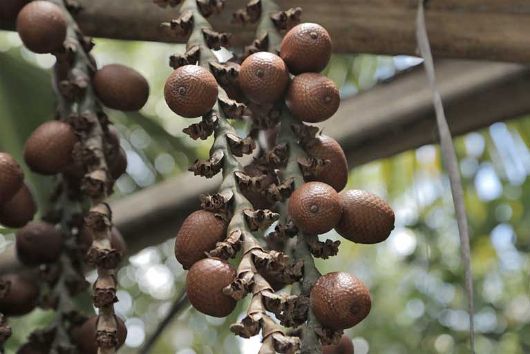
Land grabbers are also destroying the Cerrado savanna the Kalunga depend upon for their sustainable livelihoods. In addition to the rice, corn, beans and manioc they grow on subsistence plots, they supplement their diets by collecting Cerrado fruits, including buriti, mangaba, cajuzinho do cerrado, pequi and baru nuts. “It is exactly these areas, rich in edible fruits and medicinal herbs, that the [invaders] are felling to make way for [agricultural] monocultures,” Oliveira said.
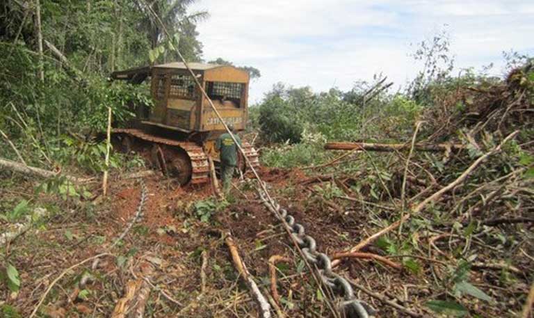
One egregious case occurred in June 2020. Land grabbers cleared 500 hectares (1,200 acres) of native vegetation to plant soy inside the quilombo. They used the highly damaging correntão system, in which a heavy chain is suspended between two large tractors that then move slowly forward, felling all that grows in their way. This land-clearing system is widely condemned for its environmental harm, but the chains are readily available for purchase on the Internet, with a video showing how they’re used.
The Kalunga made a formal land theft complaint to state authorities, who at the time were concerned about the possibility of an international boycott of Brazilian commodities due to growing alarm about increases in fires and deforestation in the Cerrado and Amazon. Officials investigated the land grab and imposed a 5 million reais ($940,000) fine on the criminals. They also acted against illegal mining in the quilombo, seizing equipment. But miners are still moving into the territory.
“People are still mobilizing, keen to mine within our territory, which is rich in gold, semiprecious stones and iron,” Oliveira said. “We suffer from this.”
These mining threats don’t only come from small-scale wildcat operators. Wealthy individuals and companies are also after the mineral wealth. In recent years, they’ve filed hundreds of requests for authorization to prospect or mine inside the territory.
In 2019, the Federal Public Ministry (MPF), a body of independent public litigators, demanded the government reject more than 150 such requests. The MPF also asked for the cancellation of all licenses and authorizations already granted by the National Mining Agency — conceded without prior consultation with the affected communities, as required by the International Labour Organization’s Convention 169, which Brazil has ratified.
‘Territories for Life’
The Kalunga are resisting these invasions with growing confidence and increasing international support. In early February, the U.N. Environment Programme and World Conservation Monitoring Centre (UNEP-WCMC) recognized the Kalunga Historical and Cultural Heritage Site as the first TICCA (Territories and Areas Conserved by Indigenous and Local Communities) in Brazil.
The UNEP-WCMC only awards this title to well-conserved traditional territories in which communities hold a deep connection with the place they inhabit, have effective internal land management and governance processes in place, and possess a good track record in promoting the welfare of the people — creating what UNEP-WCMC calls “Territories for Life.”
Rafaela Nicola, coordinator for the TICCA Consortium and director for Wetlands International in Brazil, described the first step for gaining a TICCA award: “What is different about our process is that the communities themselves, during meetings in which they discuss the tools they use for empowerment and for territorial planning, work out how becoming a TICCA would fit into their view of themselves,” she said.
A community’s recognition request is then peer-reviewed not by bureaucrats, but by leaders from traditional territories already recognized as TICCAs, to assess whether the candidate fulfills the requirements.


Vilmar Souza Costa is proud of their recognition as a TICCA, and says he believes this honor could help the 39 communities gain greater protection and respect in Brazil.
Oliveira goes further: “I believe that now we will have more partners to help us in the fight to win control over our whole territory, which we have not achieved yet.” He says he believes that TICCA recognition will also help persuade young people to stay in the quilombo. “Today many leave to study and don’t come back, because they want the security that comes from land rights and more opportunities for increasing their income,” he said.
At the moment, the quilombo’s small cash income is almost entirely from a single sustainable tourism project, run from just one of the communities. During holiday periods in the dry season, the Engenho II community in the municipality of Cavalcante receives up to 300 tourists per day, who visit the region’s impressive waterfalls.

That activity, suspended during the COVID-19 pandemic, provided an income to 300 guides from different communities, all trained by AQK, while also promoting the sale of community-made handicrafts and Cerrado products.
The quilombo’s now completed digital mapping project has paved the way for future tourism; it identified another 69 potential natural attractions that could be promoted after consultation with the communities.
Another potential georeferencing benefit: greater knowledge of the territory’s soils and their natural fertility, as well as better understanding of topography and water availability, allowing for more efficient land use and the adoption of appropriate technology — thus producing higher crop yields without degrading natural resources.
The Kalunga offer hope for other traditional and Indigenous communities and for the Cerrado biome. Scientists have made clear that industrial agribusiness, as practiced today, is not suitable or sustainable in the Brazilian savanna. But the Kalunga, with their more than 300 years of successful land management, and aided by international partners, could show a way forward for a region being increasingly impacted by deepening drought due to climate change. It appears that the world has much to learn from these traditional communities — lessons that could be of great benefit globally, and a win-win in difficult times ahead.
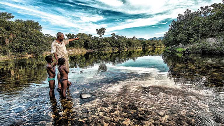
Banner image: Jorge Moreira de Oliveira, president of the Quilombola Kalunga Association. Image courtesy of Elder Miranda Jr./AQK.
FEEDBACK: Use this form to send a message to the author of this post. If you want to post a public comment, you can do that at the bottom of the page.

"traditional" - Google News
February 25, 2021 at 01:33AM
https://ift.tt/2MmEEzb
The Kalunga digitally map traditional lands to save Cerrado way of life - Mongabay.com
"traditional" - Google News
https://ift.tt/36u1SIt
Shoes Man Tutorial
Pos News Update
Meme Update
Korean Entertainment News
Japan News Update
Bagikan Berita Ini


0 Response to "The Kalunga digitally map traditional lands to save Cerrado way of life - Mongabay.com"
Post a Comment